Kenya Destinations
Kenya is not one destination. They are separated by escarpments, deserts and several hundred kilometres of road. A trip that treats the country as a single unit tends to spend more hours in transit than in the places it came to see. A trip built around two or three regions almost always works better.
This page groups Kenya’s destinations the way the country actually divides. Each group gets an orientation: what kind of trip it makes, how it differs from the others and when it works. The individual destination guides carry the detail.
Terms used throughout. A national park is state land managed by Kenya Wildlife Service under national park rules. A national reserve is protected land administered with county authorities. A conservancy is privately held or community-held land managed for wildlife under its own agreements. The distinction is not bureaucratic detail. It decides what you are permitted to do once you arrive.
Major Safari Destinations 24
Kenya's headline wildlife areas, and they do not all carry the same designation. National parks are managed by the Kenya Wildlife Service; national reserves such as the Maasai Mara, Samburu and Shaba answer to county governments; and Ol Pejeta and Lewa are private conservancies rather than state land. The rules on walking, night drives and off-road driving follow the designation, not the map.
-
 Aberdare National Park
A volcanic range on the eastern wall of the Rift Valley, the Aberdare trades savanna for montane forest, bamboo and high open moorland cut by waterfalls. It is cold, wet, thickly wooded country, home of the tree hotel and of Kenya's highest waterfall, and almost nobody arrives dressed for it.
Full guide
Photograph by GeGki, licensed under CC BY-SA 4.0
-
 Amboseli National Park
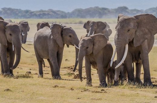
Amboseli National Park is a 392 square kilometre park in Kajiado County, southern Kenya, known for its elephant herds and for the view south to Kilimanjaro across the Tanzanian border. Most visitors arrive by road from Nairobi or fly into the park airstrip.
Full guide 15 safaris
-
Buffalo Springs National Reserve
A 131 square kilometre reserve of open lava plain south of the Ewaso Ng'iro, across the river from Samburu. Flatter, more open and less visited than its neighbour, it carries the same northern dryland species and is administered by Isiolo County under its own fee schedule.
Full guide 1 safari
-
Chyulu Hills National Park
A young volcanic range running about 100 kilometres between Amboseli and Tsavo West, gazetted as a national park in 1983. The hills have no permanent rivers: rain sinks into porous lava and resurfaces roughly 50 kilometres away at Mzima Springs in Tsavo West.
Full guide
-
 Hell's Gate National Park
Hell's Gate is the Kenyan national park a visitor can walk into, cycle through and climb in, because it carries no significant lion population. Red cliffs, volcanic towers, a slot gorge and a working geothermal field fill 68 square kilometres near Lake Naivasha.
Full guide 2 safaris
Photograph by Nina R, licensed under CC BY 2.0
-
Kakamega Forest National Reserve
Kenya's only tropical rainforest, and the last Kenyan fragment of the Guineo-Congolian belt that once crossed Africa. Kakamega holds trees, birds and primates that belong to the Congo basin rather than the savannah, split between a Kenya Wildlife Service reserve in the north and a Kenya Forest Service forest in the south.
Full guide 1 safari
-
Lake Bogoria National Reserve
Lake Bogoria is the Rift Valley lake that boils. Geysers and hot springs vent along its western shore, greater kudu browse the escarpment above, and the reserve is run by Baringo County rather than the Kenya Wildlife Service. It is Endorois land with a long, contested history.
Full guide 2 safaris
-
 Lake Nakuru National Park
A fenced 188 square kilometre park around a soda lake on the Rift Valley floor, Lake Nakuru is Kenya's most dependable rhino destination and the country's first government rhino sanctuary. Its famous flamingo flocks thinned as the lake rose, but the rhino, giraffe and birding did not.
Full guide 15 safaris
-
Lewa Wildlife Conservancy
Lewa is where the private conservancy model in Kenya began and the only wildlife conservancy in the country inside a UNESCO World Heritage property. It covers over 62,000 acres on the northern foothills of Mount Kenya and shares an unfenced boundary with Borana next door.
Full guide
-
 Maasai Mara National Reserve
The Maasai Mara National Reserve is a 1,510 square kilometre protected area in Narok County, southwest Kenya, and the most visited safari destination in the country. Most trips reach it by road from Nairobi or by light aircraft into one of its airstrips.
Full guide 30 safaris
-
 Marsabit National Park
A forested extinct volcano standing alone above the desert of northern Kenya, holding three crater lakes and a refuge for big-tusked bull elephants. The mountain makes its own weather, and Marsabit town below it is the last place on tarmac before the far north begins.
Full guide
-
Meru National Park
Meru is the park conservation history made famous and almost nobody visits. It lies east of Mount Kenya where highland farmland gives way to hot lowland bush, watered by permanent rivers, holding the Big Five, a fenced rhino sanctuary and the grave of the lioness Elsa.
Full guide 1 safari
-
Mount Elgon National Park
The volcano on the Uganda border above Kitale, where elephants mine salt underground in ancient lava tube caves and a non technical trek climbs through forest, bamboo and moorland to Koitoboss at 4,222 metres, which Kenya Wildlife Service calls the second highest peak in Kenya.
Full guide
-
 Nairobi National Park
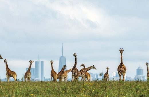
Nairobi National Park covers 117 square kilometres on the southern edge of Kenya's capital, gazetted in 1946 as the first national park in the country and in East Africa. It holds four of the big five, a significant rhino population and more than 400 bird species, within sight of the city skyline.
Full guide 4 safaris
-
Ol Donyo Sabuk National Park
Ol Donyo Sabuk is a single forested mountain rising out of farmland an easy drive from Nairobi, wrapped in a small national park built around a hiking track, a view and a grave. It is not a safari destination and has never pretended to be one.
Full guide
-
 Ol Pejeta Conservancy
Ol Pejeta is the most visited private conservancy in Kenya and the only place on earth where the last two northern white rhinos live. It covers 90,000 acres of Laikipia west of Nanyuki, and unusually for the plateau it publishes a tariff and runs public gates.
Full guide 2 safaris
-
Ruma National Park
A small, remote park on the floor of the Lambwe Valley inland from Lake Victoria, which Kenya Wildlife Service describes as the last sanctuary in the country for the endangered roan antelope. Ruma is quiet, lightly visited and specific, and the dry months matter more here than most.
Full guide
-
Saiwa Swamp National Park
Saiwa Swamp is Kenya's smallest national park, 2.9 square kilometres of wetland and riverine forest north of Kitale in Trans-Nzoia County. Gazetted in 1974 for the semi-aquatic sitatunga antelope, it is explored entirely on foot from boardwalks over the swamp, and holds over 372 recorded bird species.
Full guide
-
Samburu National Reserve
Samburu National Reserve is the anchor of northern Kenya's dry country safari circuit, and the one stop on a Kenya itinerary where the wildlife list changes almost entirely. Most safaris reach it by road from Nanyuki or by light aircraft into the reserve airstrips, then work the river frontage on morning and afternoon game drives.
Full guide 2 safaris
-
Shaba National Reserve
Two hundred and thirty nine square kilometres of lava, spring water and volcanic hill in Isiolo County, gazetted in 1974 and the least visited of northern Kenya's three linked reserves. Joy Adamson spent her last years here and was killed in the reserve in January 1980.
Full guide
-
Shimba Hills National Reserve
Shimba Hills National Reserve rises behind Kenya's south coast in Kwale County, half an hour inland from Diani, protecting one of the country's largest coastal rainforests. It holds Kenya's last breeding herd of sable antelope and a confined population of forest elephants, on a ridge that looks down to the Indian Ocean.
Full guide
-
Sibiloi National Park
The national park on the north-eastern shore of Lake Turkana, gazetted in 1973 to protect the fossil beds at Koobi Fora and the desert-adapted wildlife around them. It is a World Heritage component, a petrified forest, a crocodile stronghold and a three day drive from Nairobi.
Full guide
-
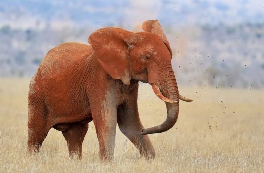 Tsavo East National Park
Tsavo East National Park is Kenya's largest national park and the closest of the big safari parks to the Indian Ocean coast, covering roughly 13,747 square kilometres of flat, red earth country in Taita-Taveta County. Voi Gate sits 156 kilometres from Mombasa on the Nairobi highway, which is why most Tsavo East safaris are sold as short coastal trips rather than long overland ones.
Full guide 4 safaris
Photograph by Volodymyr Burdiak, licensed under CC BY-SA 4.0
-
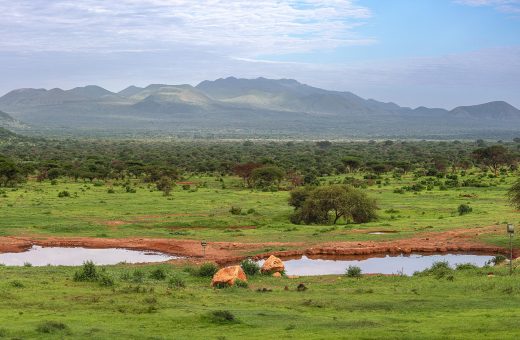 Tsavo West National Park
Tsavo West National Park is Kenya's second largest national park, a volcanic stretch of about 9,065 square kilometres in Taita-Taveta County built around lava flows, hill country and permanent springs. Mtito Andei Gate lies 240 kilometres from Nairobi and 250 from Mombasa, and Chyulu Gate connects the park directly to Amboseli, which is why most Tsavo West safaris start inland.
Full guide 5 safaris
Photograph by Ninara, licensed under CC BY 2.0
Maasai Mara Conservancies 5
Private conservancies leased from Maasai landowners along the northern and eastern edge of the Mara ecosystem. They sit outside the national reserve and set their own terms: vehicle and bed numbers are capped, and night drives, walking and off-road following are usually allowed where the reserve does not permit them.
-
Mara Naboisho Conservancy
About 22,500 hectares of leased Maasai land east of the Maasai Mara National Reserve, created in March 2010 and named with the Maa word for coming together. Naboisho caps itself at 150 beds in eight camps and is built around walking, fly camping and night drives.
Full guide
-
Mara North Conservancy
The largest of the Mara conservancies at about 29,170 hectares, leased from Maasai landowners since January 2009. It is the one conservancy that publishes its game drive rules in full, including a five vehicle limit at every sighting, and the one with riding operations.
Full guide
-
Ol Kinyei Conservancy
The first conservancy in the Mara ecosystem, formed in 2005 by 171 Maasai landowners who set land aside for wildlife with no settlement and no cattle on it. Around 7,544 hectares east of the reserve, with one tourism operator and an IUCN Green List listing from 2018.
Full guide
-
Olare Motorogi Conservancy
Roughly 15,200 hectares of leased Maasai land on the north eastern boundary of the Maasai Mara National Reserve. It is the only Mara conservancy publishing a hard ceiling on both beds and vehicles: a maximum of 94 beds in five camps and one vehicle per 2,100 acres.
Full guide
-
Olderkesi Conservancy
The smallest of the Mara conservancies, about 3,108 hectares leased inside a far larger community landholding in the far south east. It exists to keep a corridor open between the Maasai Mara, the Serengeti and the Loita Hills rather than to produce game drives.
Full guide
Laikipia 5
A plateau of conservancies and working ranches between Mount Kenya and the northern rangelands, with no national park of its own. Most boundaries are unfenced, so wildlife moves between neighbouring properties, and access is generally arranged through the conservancy rather than at a park gate. This is core black rhino and Grevy's zebra country.
-
Borana Conservancy
Borana is 28,000 acres on the Laikipia plateau and one half of something larger. The fence separating it from Lewa was taken down, joining the two into a single 93,000-acre rhino landscape held by two separate organisations, and that decision defines the place.
Full guide
-
 Laikipia
Laikipia is the high plateau running north and west from Mount Kenya, and the part of Kenya that behaves least like a national park. There is no park here, no single gate and no single tariff, only a mosaic of private and community conservancies that each set their own rules.
Full guide 1 safari
-
Loisaba Conservancy
Loisaba is 58,000 acres of northern Laikipia, drier and emptier than the conservancies around Nanyuki, and the place where black rhino returned in 2024 after fifty years away. Its title sits with a community trust rather than a family or a company.
Full guide
-
Ol Jogi Wildlife Conservancy
Ol Jogi is 58,000 acres of Laikipia plateau that became Kenya's second privately owned rhino sanctuary in 1980. It holds over a hundred rhinos and runs a wildlife rescue centre and veterinary clinic, and it is the least visitable of the major Laikipia conservancies.
Full guide
-
Segera Conservancy
Segera is around 50,000 acres of Laikipia that used to be a cattle ranch and was deliberately allowed to become something else. Owned by Jochen Zeitz and run on the Zeitz Foundation's four-pillar framework, it received a founder population of black rhino in 2025.
Full guide
Rift Valley 10
The floor of the Gregory Rift: a chain of lakes, some freshwater and some strongly alkaline, strung between volcanic cones and escarpment towns. Several are Ramsar wetlands, and the soda lakes of the Kenya Lake System carry a UNESCO World Heritage inscription for their birdlife.
-
Great Rift Valley
The Great Rift Valley is the continental fracture that shapes almost every Kenyan landscape worth travelling for: the soda lakes and their flamingos, the volcanoes, the geothermal steam and the escarpments. This page maps the region and routes a trip through it rather than describing each lake.
Full guide
-
 Iten
Iten
A small market town on the lip of the Elgeyo Escarpment at around 2,400 metres, holding a World Athletics Heritage Plaque and the most concentrated distance-running culture on earth. The ground falls away more than a kilometre into the Kerio Valley at the edge of town.
Full guide
Photograph by edskoch, licensed under CC BY 2.0
-
Kerio Valley
A hot trench running north between the Elgeyo Escarpment and the Tugen Hills, carrying the Kerio River down towards Lake Turkana. It holds a living Marakwet irrigation system on Kenya's World Heritage tentative list, two small elephant reserves, and the best paragliding air in Africa.
Full guide
-
Lake Baringo
Lake Baringo is the freshwater exception in a valley of soda lakes, and the one Rift lake where the day is spent on the water. Boats work the volcanic islands and cliffs, hippos and crocodiles are everywhere, and the rising water hit this shoreline harder than any other.
Full guide
-
Lake Elementaita
Lake Elementaita is the quiet lake between Naivasha and Nakuru, framed by the volcanic ridge called the Sleeping Warrior. It is the only place in Kenya where great white pelicans breed, a gazetted wildlife sanctuary, and one of three lakes in a World Heritage property.
Full guide
-
Lake Magadi
Lake Magadi is the southern extreme of the Kenyan Rift, a blinding white and pink salt pan on the floor of a hot, treeless depression southwest of Nairobi. It has been an industrial soda ash site since 1911 and is currently at the centre of a dispute over who mines it.
Full guide
-
Lake Naivasha
Lake Naivasha is the freshwater lake at the centre of Kenya's most accessible safari region, roughly ninety kilometres northwest of Nairobi in the Great Rift Valley. Most visits run either as a long day trip from the capital or as a two night base for boat safaris, walking safaris and the parks nearby.
Full guide 11 safaris
-
Mount Longonot
Mount Longonot is the volcanic cone every traveller sees on the Nairobi to Naivasha road, and the climb to its crater rim is Kenya's most popular day hike. It is short, steep, entirely unshaded and ends on the lip of a forested crater above the Rift Valley.
Full guide
-
Naivasha
Naivasha is a working Rift Valley town of markets, transport yards, greenhouses and power stations that happens to sit beside one of Kenya's best known lakes. The town and the lakeshore are several kilometres apart, and booking the wrong one is the commonest mistake made here.
Full guide
-
Nakuru
Nakuru is the working capital of Kenya's Rift Valley and the most useful base in the region, with hotels at every price, a large market, full services and a national park gate ten minutes from the centre. It became Kenya's fourth city in December 2021.
Full guide 1 safari
Mountains & Highlands 5
High ground above the savanna, from glaciated peaks and moorland to indigenous cloud forest and dry hill ranges. Travel here is mostly walking, trekking and climbing rather than game driving, and the birds and forest species change with every few hundred metres of altitude.
-
Cherangani Hills
A chain of forested ridges on the western wall of the Rift Valley, spanning three counties and forming one of Kenya's five main water towers. There is no park gate and no trail network, only indigenous forest, moorland, a long ridge line and the communities who farm below it.
Full guide
-
Mathews Range
The Mathews Range is a chain of forested mountains rising out of the dry plains of Samburu County, also known as the Lenkiyio Hills. Almost all of it lies inside Namunyak, a community conservancy owned and governed by the Samburu people who live around it.
Full guide
-
 Mount Kenya
Mount Kenya is the second highest mountain in Africa at 5,199 metres and the centre of a highland region that travellers visit for trekking, forest and wildlife rather than for one summit alone. It straddles the equator about 193 kilometres north east of Nairobi, with three official park gates reached from Nanyuki, Naro Moru and Chogoria.
Full guide 2 safaris
-
Ngong Hills
The Ngong Hills are the ridge on Nairobi's western horizon, a short chain of grassy summits with the city on one side and the Rift Valley dropping away on the other. They carry the capital's default day walk, Kenya's first wind farm and a famous grave in a private garden.
Full guide
-
Taita Hills
The northernmost block of the Eastern Arc Mountains, rising out of the Tsavo plains in Taita-Taveta County. A few hundred hectares of remnant cloud forest hold the entire world population of several species, including the Critically Endangered Taita apalis and Taita thrush.
Full guide
Northern Kenya 5
Arid rangeland beyond the Ewaso Nyiro, where lava country, desert and the jade water of Lake Turkana replace the green highlands. Distances are long and roads are rough, and a trip north is as much about Samburu, Rendille, Turkana and Gabbra pastoralist life as it is about wildlife.
-
Chalbi Desert
A white salt pan east of Lake Turkana in Marsabit County, lying on the bed of a lake that dried out thousands of years ago. It is crossed rather than visited, on the route between Marsabit and the lake, and the crossing is the whole of the experience.
Full guide
-
Isiolo
Isiolo is the town where the tarmac stops being a highway through farmland and starts being the road north. It sits near Kenya's geographical centre at the junction of the A2 and B4, and almost every safari heading for the northern reserves passes through it.
Full guide
-
 Lake Turkana
The largest desert lake in the world lies in the far north of Kenya, jade green against black lava and ash. Its three national parks form a World Heritage property that has been on the danger list since 2018. Reaching either shore is an expedition rather than a detour.
Full guide
Photograph by Jeffmugendi, licensed under CC BY-SA 4.0
-
Loiyangalani
A palm-shaded oasis town on the eastern shore of Lake Turkana, built around a freshwater spring in a landscape of lava and wind. It is the base for South Island National Park, the Desert Museum and the cultural festival that brings the communities of the basin together.
Full guide
-
Maralal
The headquarters of Samburu County, a cedar-fringed highland town at around 2,000 metres where the tarmac ends and the road north to Lake Turkana begins. It hosts Africa's best-known camel race and holds the house where Jomo Kenyatta spent the last months of his detention.
Full guide
Western Kenya & Lake Victoria 6
Green, high-rainfall country running down to Africa's largest lake. Tea estates on the Kericho highlands, the lake port of Kisumu, and islands with fishing villages and prehistoric rock-art sites. Very few safari itineraries come this way, which is much of the appeal.
-
Kericho
The centre of Kenyan tea, high on the wet western side of the Rift Valley where the bush is plucked in every month of the year. Kericho offers estate and smallholder tea, factory visits arranged in advance, arboreta and one of the most distinctive landscapes in the country.
Full guide
-
Kisumu
Kenya's lake city, founded as Port Florence at the end of the Uganda Railway and now the third largest urban centre in the country. Kisumu is the gateway to western Kenya, with an impala sanctuary on its lakeshore, fishing beaches at sunset and roads out to forest, tea and islands.
Full guide
-
Lake Victoria
Kenya holds the smallest share of Africa's largest freshwater lake, concentrated in the Winam Gulf and the shore south of it. What that share offers is fishing beaches, islands, rock art and dry stone archaeology rather than big game, reached through Kisumu and the small lake towns beyond it.
Full guide
-
Mbita
The small lake town at the neck of the Winam Gulf where the road meets the water. Mbita is the bridgehead for Rusinga, the boat station for Mfangano and the supply point for the southern Kenyan lakeshore, with a research campus that has been there since 1977.
Full guide
-
Mfangano Island
The hill island beyond Rusinga, reached only by boat, and home to the most significant rock art in Kenya. Mfangano is Abasuba country, its painted shelters are still used for rainmaking, and its sites sit on Kenya's UNESCO World Heritage Tentative List.
Full guide
-
Rusinga Island
The one Lake Victoria island in Kenya you can drive onto, joined to Mbita by a bridge since 2017. Rusinga carries the Miocene fossil beds where Mary Leakey found the Proconsul skull, the grave of Tom Mboya, and an Abasuba cultural festival every December.
Full guide
Central Kenya 4
The farming and market towns ringing the Mount Kenya massif, on the road between Nairobi and the northern parks. They are where highland trips are staged, guided, resupplied and slept off, and where the equator is crossed on the way north.
-
Embu
Embu is the county town on the south eastern side of Mount Kenya, where forested slopes give way to the long descent towards the Tana. It is the least visited of the towns ringing the mountain and the gateway to the Ura Gate road and the Seven Forks reservoirs.
Full guide
-
Meru
Meru is the county town on the north eastern shoulder of Mount Kenya, a busy highland market centre where the mountain's farmland runs out and the road begins its drop towards dry country. It is the last real town before the national park that shares its name.
Full guide
-
Nanyuki
Nanyuki is the town on the equator at the foot of Mount Kenya, and the place a northern Kenyan trip is actually assembled. Outfitters, airstrip, supermarkets and mechanics are all here, and so are the last reliable services before the road runs north into dry country.
Full guide
-
Nyeri
Nyeri is the working capital of the central highlands, sitting in the valley between the Aberdare range and Mount Kenya with both visible on a clear morning. More checkable Kenyan history sits within a few kilometres of the town than almost anywhere outside Nairobi.
Full guide
Nairobi 1
Where most Kenyan safaris begin and end. The capital backs onto a national park fenced on three sides and left open to the south, so plains game still moves in and out of the city's edge, and the museums, galleries and animal sanctuaries around town fill the day either side of a flight.
-
 Nairobi
Nairobi is Kenya's capital and the arrival point for almost every safari in the country, a city of roughly 4.4 million people sitting at 1,795 metres in the central highlands. International flights land at Jomo Kenyatta International Airport and light aircraft for the parks leave from Wilson Airport.
Full guide 16 safaris
Photograph by Antony Trivet, licensed under CC BY-SA 4.0
Kenya Coast 15
The Indian Ocean shore, from the Tanzanian border to the Lamu archipelago: reef-sheltered beaches, Swahili towns built of coral rag, and the creeks and delta behind them. Lamu Old Town is a UNESCO World Heritage Site, and the kaskazi and kusi monsoons set the seasons here rather than the inland rains.
-
Chale Island
Chale is a small coral island a few hundred metres off Kenya's south coast, just below the Diani strip, reachable on foot across the flats at low tide. Its southern half is a Digo sacred site and its northern half holds a single resort.
Full guide
-
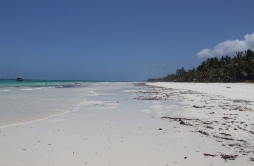 Diani Beach
Diani Beach is a seventeen kilometre stretch of coral sand on Kenya's south coast, running from the Mwachema River mouth down to Galu, and it is the country's busiest beach destination outside Mombasa. Most visitors arrive on a short flight into Ukunda or by road from Mombasa, thirty kilometres north.
Full guide
Photograph by Nicor, licensed under CC BY 3.0
-
Kenya Coast
Kenya's Indian Ocean coast runs more than 536 kilometres across five counties, from the Tanzanian border to the Somali one. It is a region in its own right, with a thousand-year trading history, six marine parks and four World Heritage properties, and this guide routes you to the right part of it.
Full guide
-
Kilifi
Kilifi sits 56 kilometres north-east of Mombasa on a wide tidal creek, and it is the least resort-like of the main coastal towns. The creek gives it a boating culture the open coast cannot match, and a Swahili ruin stands on the bluff above it.
Full guide
-
Kiwayu Island
Kiwayu lies at the far north-eastern end of the Lamu archipelago, inside Kiunga Marine National Reserve and close to the Somali border. Travel advice currently covers it, and much of what is written about the island online has not been updated since 2011.
Full guide
-
 Lamu
Lamu
Lamu is an island town about 350 kilometres north of Mombasa, and its old town is the oldest and best preserved Swahili settlement in East Africa, inscribed on the UNESCO World Heritage List in 2001. Visitors fly to Manda airstrip and cross by boat, because no road reaches the island and almost nothing with an engine once you are there.
Full guide
Photograph by Nite_Owl (Flickr), licensed under CC BY 2.0
-
Malindi
Malindi is a working coastal town about 120 kilometres north of Mombasa, and it is the one place on the Kenya coast where five centuries of arrivals are still legible on the ground. Visitors reach it by a short flight from Nairobi or Mombasa, or by road up the coast highway.
Full guide
-
Manda Island
Manda is the island everyone arriving in the Lamu archipelago lands on, because the airstrip is here. It also holds Takwa and the ninth-century ruins of Manda town, one of the oldest excavated Swahili settlements anywhere on the East African coast.
Full guide
-
Mombasa
Mombasa is Kenya's second city and its main Indian Ocean port, a Swahili town built on a coral island roughly five hundred kilometres southeast of Nairobi. Most visitors arrive by air or by the Madaraka Express railway and use it as the gateway to the coast, though the city itself carries enough history for two or three full days.
Full guide 1 safari
-
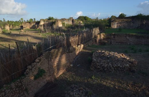 Pate Island
Pate is the largest island in the Lamu archipelago and was Lamu's rival for centuries. It holds Siyu Fort, the standing remains of Pate town and the eighth-century site at Shanga. Travel advice currently covers the island, and this guide states where that stands.
Full guide
Photograph by Jeffmugendi, licensed under CC BY-SA 4.0
-
 Shela
Shela
Shela is a village at the southern end of Lamu Island, about forty minutes on foot from Lamu town, and it is where the beach is. Twelve kilometres of open sand run south from it, and the dunes behind that sand are the island's entire fresh water supply.
Full guide
Photograph by Adebola Falade, licensed under CC BY-SA 4.0
-
Shimoni
Shimoni is a fishing village at the far southern end of the Kenyan coast, facing Wasini Island across a narrow channel. Boats leave from here for the best reef in the country, and beneath the village run the caves that gave it its name and its history.
Full guide
-
Tana River Delta
The Tana River Delta is Kenya's coastal Ramsar site, listed in 2012 and covering 163,600 hectares of floodplain, mangrove and beach. It is the second most important deltaic ecosystem in Eastern Africa, and travel advice currently restricts parts of it.
Full guide
-
 Wasini Island
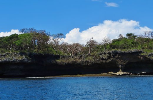
Wasini lies three kilometres off the far south coast, opposite Shimoni. It has no cars, no road, no mains power and no groundwater, and those absences shape everything about it. Most visitors see it for an hour at lunch and miss the island entirely.
Full guide
Photograph by Frédéric Ducarme (FredD), licensed under CC BY-SA 3.0
-
 Watamu
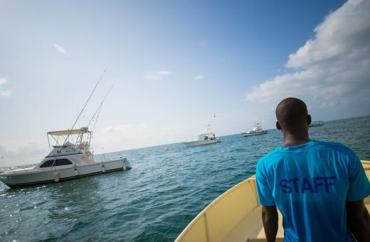
Watamu is a small village on a headland about 105 kilometres north of Mombasa and roughly 20 kilometres south of Malindi, built around three bays and one of the oldest protected reefs in Africa. Most visitors come for the water and stay inside a twenty minute radius.
Full guide
Marine Parks & Reserves 6
Kenya's protected reef and inshore waters. The distinction matters in the water: a marine national park is a no-take zone closed to fishing, while the marine national reserve around it allows traditional fishing, so the designation decides where you can snorkel, dive or go out with a boat.
-
Diani-Chale Marine National Reserve
Diani-Chale Marine National Reserve covers roughly 75 square kilometres of water running south from Diani Beach past Chale Island in Kwale County. Kenya Wildlife Service gazetted it in 1995 over community objection, and it has never been brought into active management. It sits in the national fee band regardless.
Full guide
-
 Kisite-Mpunguti Marine National Park
Kisite-Mpunguti is the furthest south of Kenya's marine protected areas, a group of coral islands eleven kilometres off Shimoni in Kwale County. A 28 square kilometre no-take park surrounds Kisite Island and an 11 square kilometre reserve covers the Mpunguti islands. The only way in is by boat.
Full guide
Photograph by Snake3yes, licensed under CC BY 2.0
-
Kiunga Marine National Reserve
Kiunga Marine National Reserve protects 270 square kilometres of reef, mangrove and low limestone islands along Kenya's far northeastern coast in Lamu County. Gazetted in 1979, it holds the country's dugongs and its tallest mangroves, and it lies inside an area currently under an advisory against travel.
Full guide
-
Malindi Marine National Park
Malindi Marine National Park and Reserve runs south from the Vasco da Gama Pillar towards Watamu, covering 213 square kilometres of fringing reef, lagoon coral gardens, seagrass beds, mangrove and mudflat. Kenya Wildlife Service gazetted it in 1968, at the same time as the Watamu components.
Full guide
-
Mombasa Marine National Park
Mombasa Marine National Park and Reserve protects the reef off the city's north coast hotel strip, a ten square kilometre no-take core inside a two hundred square kilometre reserve. Gazetted in 1986 and effectively protected from 1991, it is reached by boat from five named beach gates.
Full guide 1 safari
-
Watamu Marine National Park
Watamu Marine National Park is ten square kilometres of no-take reef and lagoon in front of Watamu village in Kilifi County, gazetted on 26 March 1968 and among the oldest protected marine ecosystems in Africa. The surrounding reserve takes in Mida Creek, and the conservation fee applies to anyone entering the water.
Full guide
Attractions and Sites 91
The individual places within each destination: the falls, caves, hot springs, palaces, tombs, rocks and landing sites. Grouped by the destination they sit in. Several are written up because the name circulates and the site does not, which is worth knowing before you plan a drive around one.
Malindi 5
Mombasa 6
Nairobi 12
Parks, Reserves and Conservancies
Two destinations with identical wildlife can offer completely different holidays because of how the land is held. Kenya Wildlife Service publishes the rules that apply in the national parks it manages: visitors remain in the vehicle except in designated areas, off-road driving is prohibited, and gates open at 6:00 AM and close at 6:00 PM unless you are staying inside overnight.
Conservancies operate under their own management agreements on private or community land, which is why walking with an armed guide, driving after dark and following an animal off the road are routinely available there and generally not in the parks. National reserves sit between the two, administered with county authorities, and their rules vary by reserve.
Reading a destination guide. Check the designation first, then the activity list, then the terrain. Two of those three are decided before you arrive, and only one of them is visible in the photographs.
Pacing a Kenya Route
The most common planning error on a first Kenya trip is stacking destinations. Trip reports and traveller forums return to the same complaint with unusual consistency: the distances between regions were underestimated, the itinerary looked balanced on paper, and the trip turned into a sequence of transfer days with short bursts of wildlife at either end. Two nights in a place is generally treated as the floor for it to be worth the journey there, and a great deal of Kenya rewards three.
The regions on this page are grouped partly to make that arithmetic visible. The Rift Valley lakes cluster tightly and combine easily. The Mara, Amboseli and the Tsavos are each a substantial move. The north and the far west are commitments rather than detours. The coast is best treated as a separate half of the trip. Air transfers change this calculation significantly, which is the real argument for a fly-in itinerary in a country this shape.
How Destinations Relate to Attractions and Activities
A destination page answers where to go. It names the sights inside that place and links to them, but it does not describe them at length, because each one has its own page nested beneath it. The Mara River, for example, is reached through the Maasai Mara rather than sitting on its own at the top level of the site, and the full index of named sights is at Kenya attractions.
If you have not yet settled what you want to do, start at things to do in Kenya instead, then come back here. Commercial trips sold by independent operators are compared under Kenya safaris, which is a separate section from these guides by design so that the planning content and the products stay out of each other’s way.
Questions About Kenya’s Destinations
How many destinations should one trip cover?
Fewer than most first drafts contain. The limiting factor is road transfer time between regions, which is consistently underestimated, and the fact that a game drive is most productive at dawn, exactly when a travel day has to start. Two or three areas is the pattern that trip reports describe as working, with at least two nights in each so the journey there buys you something. Flying between regions changes the maths and is worth pricing against the days it saves.
What is the real difference between a national park, a national reserve and a conservancy?
Ownership and rules rather than wildlife. National parks are state land under Kenya Wildlife Service rules, which require you to stay in the vehicle outside designated areas, prohibit off-road driving and operate fixed daytime gate hours. National reserves are protected land administered together with county authorities, and their rules vary. Conservancies are private or community land managed under their own agreements, which is why walking, night drives and off-road tracking are generally possible on them. Adjacent areas with the same animals can therefore offer very different experiences.
Which regions work for a first visit to Kenya?
The major safari destinations and the Rift Valley are the most straightforward, because they are well served by roads and airstrips and they deliver the classic experience without long committing drives. The coast pairs naturally with any of them as a second half. Northern Kenya and western Kenya are genuinely rewarding but ask for more time, more tolerance of rough travel and usually some prior African travel experience, so they tend to suit a second trip.
Are Kenya’s World Heritage sites spread across these regions?
They are, which is a useful way to see how different the regions are from one another. The inscribed sites include Mount Kenya National Park and Natural Forest in the highlands, the Lake Turkana National Parks in the north, the Kenya Lake System in the Rift Valley, Thimlich Ohinga in the Lake Victoria basin, and Lamu Old Town, Fort Jesus, the Sacred Mijikenda Kaya Forests and the historic town and archaeological site of Gedi on the coast. No single region carries the set.
Can a coastal holiday and a safari be combined?
Easily, and it is one of the most common shapes a Kenya trip takes. The two halves have opposite rhythms, so they work best in sequence rather than interleaved. The usual order puts the safari first, while enthusiasm for 5:30 AM starts is still intact, and the coast second. Flights connect the main coastal towns with the principal safari airstrips, which removes the long road transfer that otherwise eats a day.
Does this site sell trips to these destinations?
No. This is a marketplace that compares Kenya safaris sold by independent tour operators. It takes no bookings, handles no payments and charges travellers nothing. Its job is to lay the options out clearly and route an enquiry to the operator who actually sells the trip. The destination guides are written to help you choose, not to sell you anything, and operators are never ranked or recommended against one another.