
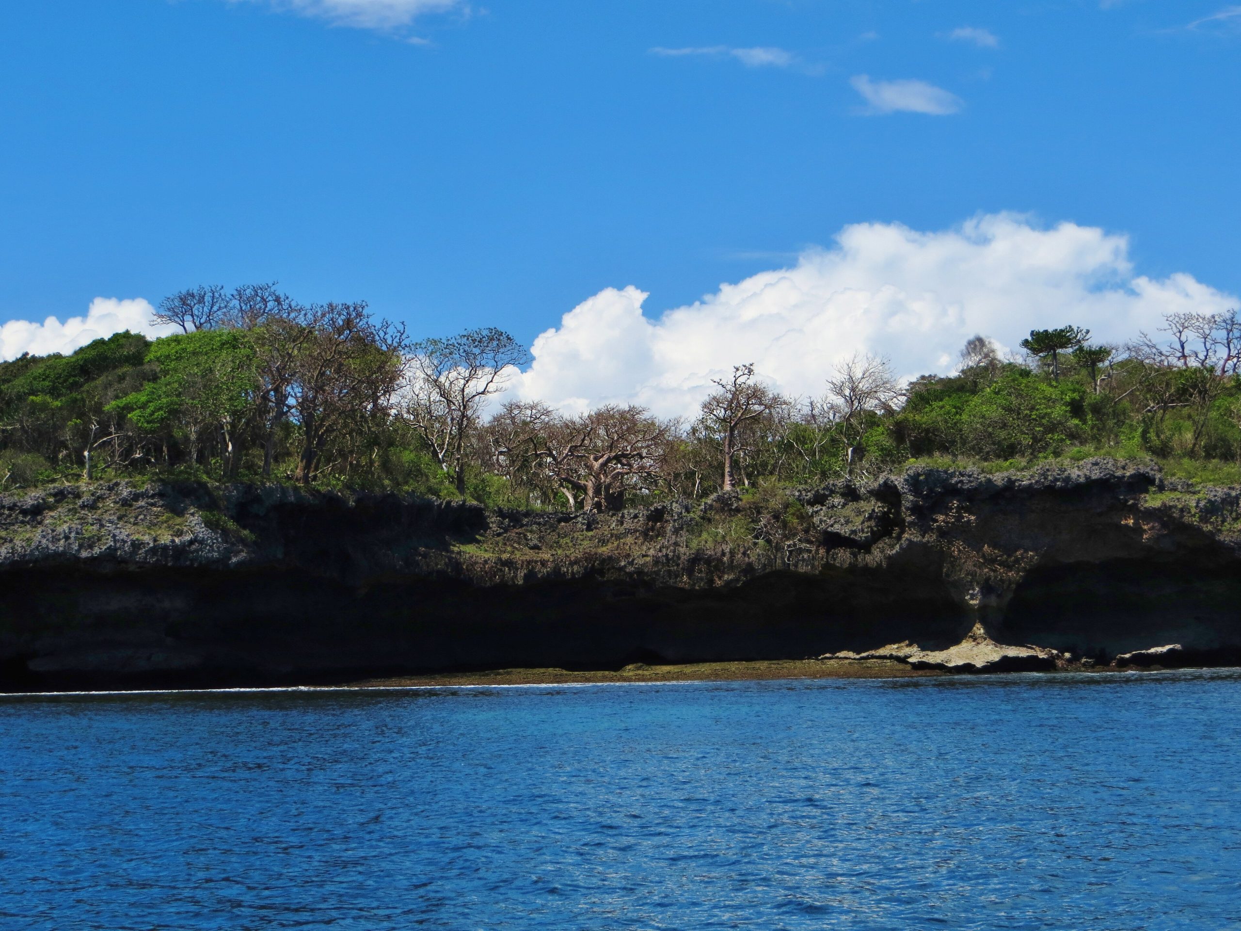
Wasini Island
Wasini Island lies about three kilometres offshore at the far southern end of the Kenyan coast, roughly 75 kilometres south of Mombasa and directly opposite the village of Shimoni. It is around seven kilometres long and three across. It has no vehicles, no road, no mains electricity and no groundwater, and every one of those absences shapes what a visit to it is like.
Nearly everyone arrives as part of a day trip to Kisite-Mpunguti Marine National Park, sees the island for an hour at lunch, and leaves thinking there is nothing there. That is the single most common misreading of the place, and the reason this guide is organised around the island rather than around the excursion.
An Island With No Cars and No Groundwater
Wasini is a slab of fossil coral. There is no soil depth to speak of across much of it and there is no fresh groundwater at all, so every drop of water used on the island is rainwater, caught from roofs into tanks and carried by hand or by handcart to where it is needed. A small number of communal catchments serve the villages, and water carrying is a paid occupation.
There are no cars, no carts drawn by animals and effectively no bicycles, because the paths are old coral and cannot take them. Getting about means walking the footpaths, walking the beaches when the tide allows it, or taking a boat. There is no grid connection; households run on solar panels, and the number of panels has grown a great deal in recent years.
None of this is presented on the island as hardship or as a spectacle. It is simply how a small island without a freshwater lens works. For a visitor it means two practical things: carry water rather than expecting to buy it easily, and wear something more substantial than flip-flops, because the coral underfoot is genuinely sharp.
Wasini Village, Mkwiro and Nyuma Maji
The island has two main settlements, both on the southern shore facing the mainland. Wasini village sits at the western end and is where the day boats tie up. Mkwiro is further east, smaller and considerably less visited, with a primary school and a community that lives mainly by fishing. Inland between them is the hamlet of Nyuma Maji, whose name means behind the water.
Walking from Wasini to Mkwiro takes roughly an hour and a half along the shore and through the interior, and it is the best thing an independent visitor can do here. The path passes through the coral scrub, past baobabs, and along tidal flats that are walkable at low water and not at high. Ask about the tide before setting off, because getting the timing wrong turns a walk into a wait.
Both villages are Muslim and modest dress matters here more than it does on a hotel beach: covered shoulders and knees, and swimwear kept for the boat and the reef.
The Coral Garden Boardwalk
The island’s own attraction is the Wasini Coral Garden, behind the village on the eastern side. At low tide it is a field of fossil coral, weathered into spikes and hollows, standing above a mangrove fringe. At high tide the sea floods it and the whole thing goes under.
A raised wooden boardwalk of more than 500 metres loops out across it, so that both states are walkable. The boardwalk is run by the Wasini Women’s Group and was built under the Biodiversity Conservation Programme, a joint venture between the Kenyan government and the European Commission, as an income-generating alternative to cutting the mangroves. It is one of the more successful community conservation projects on the coast and the entry charge goes to the group that maintains it.
Going at high tide and going at low tide are different outings. Low water shows the coral formations; high water turns the walk into a causeway over the sea with mangrove on either side. The mangrove tours guide covers the ecology in more detail.
Kisite-Mpunguti From Wasini
Kisite-Mpunguti Marine National Park and Reserve lies a short run south-east of the island and is the reason most boats are in this water at all. The park holds the best hard coral cover in the Kenyan marine system and the most reliable sightings of larger animals, and the crossing regularly produces dolphins.
Entry is charged per person per day by Kenya Wildlife Service under one band covering all six of its marine protected areas: non-resident adults USD 25 and non-resident children or students USD 15, African citizens USD 15 and USD 10, Kenya residents KES 675 and KES 350, East African citizens KES 500 and KES 250. Those figures come from the KWS conservation fee schedule dated October 2025, checked against the published schedule on 21 September 2026. A non-resident figure of USD 40 circulates in search results and does not appear in that schedule.
Where the diving and the snorkelling is best, and what the coral is actually like, belongs with the scuba diving and snorkelling guides.
What the Day Trip Is Actually Like
The standard shape is an early departure from Shimoni, a run out to the park, two or three snorkelling stops, then across to Wasini for a long seafood lunch, and back in the early afternoon. It is a good day out. It is also the version of this island that produces the most complaints, and the reasons are consistent enough to be worth stating.
- Shade. Many of the boats have limited cover and the water reflects everything back. Sunburn on this trip is common and it is the single thing most often regretted. A long-sleeved layer beats sunscreen alone.
- Crowding at the same spots. Boats tend to converge on the same pod of dolphins and the same snorkelling sites, and the busiest sites show the most bleached and broken coral. Going early, or going on a quieter day, changes the experience more than choosing between operators does.
- Water. Lunch being included does not always mean drinking water is included. Carry some.
- Time on the island. The lunch stop is usually an hour or so, which is enough for the meal and not much else. The boardwalk and the village walk both need longer.
The day trip is the right choice for most visitors. It is simply worth understanding that it is a boat trip that stops at Wasini, not a visit to Wasini.
Staying Overnight on Wasini
A handful of small guesthouses in the villages take overnight guests, and staying turns the island into a different place entirely. The day boats leave in the early afternoon and the island goes quiet. The walk to Mkwiro becomes possible without a clock running. The boardwalk can be seen at both states of tide. Reaching the marine park early, before the Shimoni fleet arrives, becomes straightforward.
The trade-offs are real and worth knowing in advance. Water is limited and rationed by what the tanks hold, so showers are brief and conserving water is expected rather than requested. Power is solar and may not run through the night. There is no bank, no pharmacy and very little to buy, so cash and any medication need to come with you. Food is fish and what the boat brought over.
For travellers who want the far south coast rather than a day out from Diani, this is the way to have it.
Getting There and Moving Around
Boats cross from Shimoni harbour, about three kilometres away, and the crossing takes a matter of minutes. Local passenger boats run for residents throughout the day and are the cheapest way over for an independent visitor; excursion boats run to their own schedule. A passenger service also runs from this stretch of coast to Pemba in Tanzania.
Shimoni itself is reached by road from Diani Beach in about an hour and a half, and from Mombasa via the Dongo Kundu bypass, which removed the Likoni ferry from that journey when it opened in August 2024.
On the island, everything is on foot or by boat. Distances are short but the surface is not forgiving, and the beaches that shorten a walk are only there at low water.
Questions Travellers Ask About Wasini Island
Is Wasini Island worth visiting on its own, or only as part of a boat trip?
On its own, if the interest is the island rather than the reef. The coral garden boardwalk, the walk to Mkwiro and the village itself need more than the hour a day trip allows. Visitors who only see it at lunchtime routinely conclude there is nothing there, which says more about the schedule than about the island.
How do you get to Wasini Island?
By boat from Shimoni harbour on the mainland, about three kilometres away and a short crossing. Shimoni is roughly an hour and a half by road from Diani Beach and about 75 kilometres south of Mombasa. There is no bridge and no vehicle ferry, because there is nothing on the island for a vehicle to do.
Is there fresh water on Wasini?
No groundwater at all. Everything is rainwater collected in tanks, carried by hand, and rationed accordingly. Visitors staying overnight should expect short showers and should carry drinking water rather than assume it is easy to buy.
What should you wear and take to Wasini?
Closed shoes or sturdy sandals, because the paths are sharp fossil coral. A long-sleeved layer and a hat, because the boats offer limited shade. Modest clothing for the villages, which are Muslim. Reef-safe sunscreen, drinking water, and cash, since there is nowhere to draw any.
Do you pay to walk the coral garden boardwalk?
Yes, there is an entry charge, and it goes to the Wasini Women’s Group who built and maintain the boardwalk. It is separate from the marine park conservation fee, which only applies if the trip enters Kisite-Mpunguti.
When is the best time to visit Wasini?
November to March, during the kaskazi monsoon, for the calmest crossing and the clearest water. July to September is dry but windy, with rougher water and more cancelled boats. Late April through May carries the coastal long rains. Within any day, mornings are calmer than afternoons on this channel.
Wasini sits at the end of the south coast run with Shimoni, Kisite-Mpunguti, Chale Island and Diani Beach. For the coast as a whole, start at the Kenya Coast.
1 Place to Visit in This Area
Individual sites within reach of here, each with its own guide. Some are written up because the name circulates and the place does not, which is worth knowing before you plan a drive around one.
No operator on the marketplace currently lists a safari to Wasini Island.
See every Kenya safari