
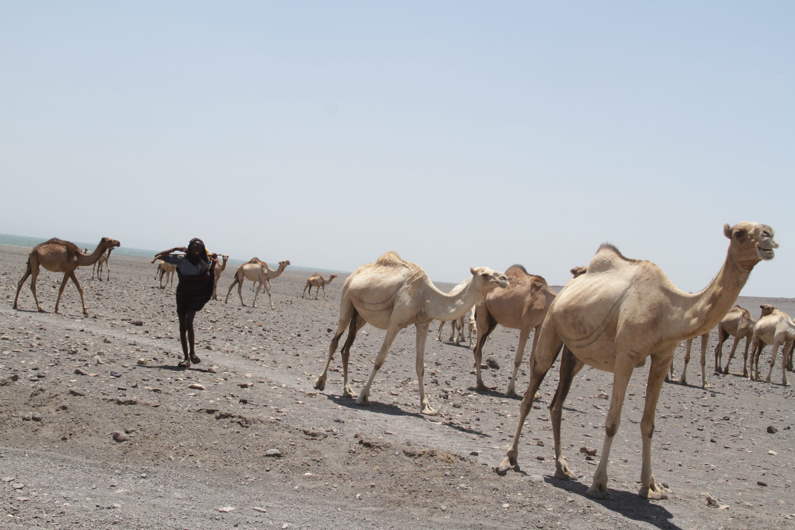
Lake Turkana
Lake Turkana is the largest desert lake in the world and the most saline of the large lakes in East Africa, a 249 kilometre body of jade-green water lying in the floor of the Rift Valley from the Ethiopian border down into the dry heart of northern Kenya. UNESCO records it as 44 kilometres across at its widest point, with a depth of 30 metres, and ranks it the fourth largest lake in Africa. Almost nothing about reaching it is casual.
It is also, and this is the part most travel writing leaves out entirely, a World Heritage property that has sat on the List of World Heritage in Danger since 2018. That fact shapes what is happening to the lake, to its fisheries and to the people who live around it more than any other single thing a visitor could be told.
Where Lake Turkana Is and What It Looks Like
The lake occupies the northern end of the Kenyan Rift, reaching across the border into Ethiopia at its top end. Its main inflow is the Omo River, which enters from the north and supplies the overwhelming majority of the water; the Turkwel and the Kerio come in from the west and south-west, the Kerio draining the Kerio Valley and the Cherangani Hills far to the south.
The colour that gives the lake its nickname, the Jade Sea, comes from algae in the surface water and changes hour by hour with the light and the wind. The shoreline is volcanic: black lava beaches, ash cones, sand spits and, in places, petrified wood. The surrounding country is arid to the point of looking uninhabited, which it is not. Wind is a constant. It funnels down the rift and gets up with enough force in the afternoons to make boat movement genuinely unsafe, and that single fact governs more daily schedules around the lake than anything else.
Three national parks protect parts of the lake and its shore: Sibiloi on the north-eastern shore, and the island parks of South Island and Central Island. Together they cover 161,485 hectares inside a basin whose total surface area UNESCO puts at seven million hectares.
The World Heritage Property and Why It Is Listed In Danger
Lake Turkana National Parks were inscribed on the World Heritage List in 1997 under natural criteria (viii) and (x), with a significant boundary modification in 2001. The property is a serial one: Sibiloi, South Island and Central Island, co-managed by the Kenya Wildlife Service and the National Museums of Kenya. Criterion (viii) rests on the geology and the fossil record; criterion (x) on the habitats and the more than 350 bird species recorded.
On 28 June 2018, at its session in Manama, the World Heritage Committee placed the property on the List of World Heritage in Danger. UNESCO’s own statement names the cause: concern about changes to the hydrology of the Turkana basin, and in particular the disruptive effect of Ethiopia’s Gibe III dam on the flow and the ecosystem of the lake, with the Kuraz sugar development project posing a further threat and the potential impacts of the LAPSSET transport corridor also noted. IUCN, which advised the Committee, records that water levels fell downstream of the dam once its reservoir began filling in January 2015, and that the Omo is the single most important source of water for the lake. The property remains on the danger list.
A correction worth carrying: the popular story is that Lake Turkana is drying up. Published hydrological work on the Rift Valley lakes records the opposite through the 2010s and into the 2020s. The lake level rose, shorelines advanced inland and lakeside settlements and infrastructure flooded. The concern behind the danger listing is not simply that the lake shrinks but that a regulated Omo has flattened the seasonal flood and drought cycle the lake and its fisheries evolved around. Anything read about water levels here should be dated.
The Western Shore: Lodwar, Kalokol and Eliye Springs
The western side is the easier half of the lake to reach and the one most independent travellers see. Lodwar is the capital of Turkana County and the base for everything on this shore, with an airstrip carrying the only scheduled commercial flights anywhere in the basin. Turkana County Government gives the road distance from Nairobi through Eldoret and Kitale as 640 kilometres on tarmac.
Eliye Springs, which the county puts 50 kilometres east of Lodwar near the mouth of the Turkwel, is the usual lakeside stop: palms, a dune, sand and a long view over the water. Kalokol, north of Lodwar, is the centre of the Turkana fishing industry and the launching point for boats to Central Island. Between the two lies Ferguson’s Gulf, a broad shallow bay that concentrates birds, and the Namoratunga standing stones on the Lodwar to Kalokol road. Further south, the county also names the Lokori standing stones and rock art, and the hot waterfalls at Kapedo.
Nariokotome, on this shore, is where the near-complete Homo erectus skeleton universally known as Turkana Boy was found in 1984. It is an open research locality with a monument rather than a visitor site, and the published age of the specimen varies between sources, so the figure is best taken from the National Museums of Kenya rather than from a brochure.
The Eastern Shore: Loiyangalani, South Island and Mount Kulal
The eastern shore is harder, emptier and, for most visitors, the more memorable. Loiyangalani is the only town of any size on this side, built around a freshwater spring, and it is the base for South Island National Park, for boat trips on the lake and for the Lake Turkana Cultural Festival. Behind it rises Mount Kulal, an eroded extinct volcano whose mist forest forms the core of the Mount Kulal Biosphere Reserve, designated by UNESCO in 1978 and now also on Kenya’s World Heritage tentative list.
South Island is volcanic ash from end to end. The Kenya Tourism Board records the nightly glow of its vents, which has produced a long local literature of ghosts and spirits, and describes a bird list that includes 34 species of European migrants best seen as they head home between March and May, with at least 23 species breeding on the island, among them Goliath heron and African skimmer. Kenya Wildlife Service adds that a rocky islet roughly 20 kilometres to the north is a breeding site for great cormorant, reed cormorant and red-headed gull.
The road in from the south passes the wind farm on the ridge above the lake, which is the last piece of large infrastructure before the shore and a useful landmark for anyone navigating by description rather than by signpost.
Sibiloi, Koobi Fora and the Fossil Record
Sibiloi National Park, on the north-eastern shore, is the reason the basin is internationally famous. It holds Koobi Fora, the fossil locality whose finds reset the study of human origins across the second half of the twentieth century, and it holds a petrified forest on the flank of Mount Sibiloi that the Kenya Tourism Board describes as the only one of its kind in the country. UNESCO’s account of the property lists hominin remains of five species recovered within the one area.
Sibiloi is treated in full on its own page, and the wider subject of visiting Kenya’s prehistoric sites, including which specimens are actually on display and where, sits under archaeological tours in Kenya. Neither is a detour from anywhere. Reaching Sibiloi is a dedicated expedition.
Central Island and the Crocodiles
Central Island National Park protects a five square kilometre volcanic island in the middle of the lake, reached by boat from Kalokol. Kenya Wildlife Service describes three active volcanoes and three crater lakes, Crocodile, Flamingo and Tilapia, formed as craters merged, and calls the island the breeding ground for the world’s largest concentration of Nile crocodiles. Its local name, Chooro, means crocodile island.
On the crocodile population itself, the most-quoted figure is old and should be labelled as such: an estimate of 14,000 animals from a survey by Alistair Graham published in 1968. Nothing more recent circulates with that authority, so a number without that date attached is not a number worth repeating.
There is a campsite on Central Island, and the island is small enough to climb in about an hour. Wind decides whether the crossing happens at all.
Park Fees at the Three Lake Parks
Sibiloi, Central Island and South Island all sit in the Kenya Wildlife Service Special Interest band, the cheapest tier of national park entry in the country. Rates are per person per day.
| Category | East African citizen (KSh) | Kenya resident (KSh) | Non-resident (USD) |
|---|---|---|---|
| Adult | 500 | 675 | 40 |
| Child or student | 250 | 350 | 20 |
African citizens from outside East Africa pay USD 20 for an adult and USD 10 for a child. Public campsites in these parks are KSh 200 for an East African citizen adult and USD 20 for a non-resident adult per night, with special campsites higher. A motor vehicle with fewer than six seats is KSh 600 a day. Cycling at Sibiloi carries a charge of KSh 300 or USD 10 a day on top of entry, and motorcycles KSh 500 or USD 10; Sibiloi is one of a short list of parks where either is permitted at all.
Aircraft landing charges are banded by weight, starting at USD 10 for anything up to 1,500 kilograms. Helicopter landing at Central Island and South Island carries a flat charge of USD 300, which is an unusually concrete number for a region where most logistics are quoted vaguely. These figures come from the Kenya Wildlife Service conservation fee schedule and were checked on 21 September 2026.
Getting to Lake Turkana
There are three practical approaches and they do not connect easily to each other. Crossing between the western and eastern shores is a boat journey on a lake that turns dangerous in the afternoon, not a short hop.
- West, by road. Nairobi to Eldoret to Kitale to Lodwar, 640 kilometres on tarmac according to Turkana County Government, then local roads to Eliye Springs or Kalokol.
- West, by air. Scheduled flights serve Lodwar. This is the only commercial air service in the basin and it removes the longest drive in the country from the plan.
- East, by road. Kenya Wildlife Service describes South Island as a 600 kilometre drive from Nairobi by way of Isiolo and Laisamis or through Marsabit and South Horr, with tarmac giving way to murram. The alternative eastern line runs Nairobi to Maralal, South Horr and Loiyangalani, or through Marsabit and across the Chalbi Desert by way of Maikona, Kalacha and North Horr.
- Sibiloi. Kenya Wildlife Service gives a three day, 800 kilometre drive from Nairobi through Marsabit and North Horr, or through Maralal and South Horr, or a road journey to Kalokol followed by a boat across to Alia Bay. Two all-weather airstrips lie inside the park.
High clearance four-wheel drive is essential on the eastern routes year round and the wildlife service recommends travelling in convoy. Two vehicles is the working rule rather than an abundance of caution, because a recovery on the Chalbi or between North Horr and Loiyangalani depends on the party that is already there. Fuel, water and spares are carried, not found. For anyone who would rather not drive it, fly-in safaris and self-drive safaris cover the two ends of that choice.
When to Go, and What the Heat Actually Does
Heat is the constraint on everything in the basin, not rain. The working pattern is early starts, a long pause through the middle of the day and activity again in the late afternoon, with boat movement planned for the calm of the morning rather than the wind of the afternoon.
The rains, such as they are, fall long from March into May and short from October into December, and they matter less for the lake shore than for the ground between it and everywhere else. Wet weather turns the Chalbi crossing into a trap and makes murram sections slow, so the drier stretches from June to September and from January to early March are the more reliable travelling windows. Migrant birds returning through the lake parks between March and May are the counter-argument for the shoulder.
The People of the Lake
The basin is a working pastoral and fishing landscape, not a wilderness. Turkana County, the largest county in Kenya at 68,232.9 square kilometres, recorded a population of 926,976 at the 2019 census. Around the lake and inland live Turkana, Dassanach, Gabra, Rendille, Samburu, Borana, Waata and El Molo communities, the last of these numbering 1,104 at the 2019 census and among the smallest communities in the country.
Cultural tourism here is undeveloped and that is a feature of the place rather than a fault in it. The subject, including the two festivals and the etiquette that ought to govern photography, is handled at length under Turkana cultural experiences, and the interpretation centre for the eastern communities is the Loiyangalani Desert Museum.
Safety, Permission and Plain Practicality
Conditions across northern Kenya vary by route and by season, and they change. Parts of the wider region are affected by livestock raiding and by competition over water and grazing, and some roads are travelled in convoy for that reason as well as for mechanical ones. None of that makes the basin a no-go area: these are inhabited places where people live, work, trade and go to school.
The durable advice is to check the current travel advice published by your own government close to departure, take local guidance on the day about specific roads, and travel with people who know the ground. A local guide or fixer is not an optional flourish in this part of Kenya. Language, permissions, fuel, water and the simple business of finding a place all run through people rather than through websites.
Carry far more water than seems necessary, plus rehydration salts. Sun cover matters more than warm clothing, although nights on the higher eastern approaches are cold. Cash is needed in small denominations, mobile coverage is patchy and intermittent, and single-use plastic is prohibited in the national parks.
Questions Travellers Ask About Lake Turkana
Is Lake Turkana worth the journey?
It depends entirely on what the traveller is after. For wildlife density it does not compete with the Maasai Mara or Amboseli and never will. For landscape, emptiness, geology, deep human history and the sense of being somewhere genuinely remote, there is nothing else in Kenya like it. It suits a second or third trip better than a first.
Which shore should I choose?
The western shore, based on Lodwar, is easier, cheaper and reachable by scheduled flight. The eastern shore, based on Loiyangalani, is harder and more dramatic and puts South Island, Mount Kulal and the Chalbi within reach. Trying to do both in one trip means either a long boat crossing or a very large loop by road.
How long does a trip to Lake Turkana take?
Flying to Lodwar makes a three or four night trip realistic. Driving the eastern loop from Nairobi through Marsabit or Maralal and back is a week at an absolute minimum and more comfortably ten days, because the driving days are long and the roads set the pace rather than the plan.
Can you swim in Lake Turkana?
The lake holds a very large crocodile population, and the island parks are described by the wildlife service as major crocodile breeding grounds. Local advice about which stretches of shore are used and which are not should be followed exactly, and taken from people who live there rather than from a guidebook.
Do I need a four-wheel drive?
On the eastern approaches, yes, high clearance four-wheel drive year round, and travelling in two vehicles is the sensible norm. The western route to Lodwar is tarmac for the length of it, though the local roads out to Eliye Springs and Kalokol are not.
When is the Lake Turkana Cultural Festival?
The dates move substantially between years and between the Loiyangalani and Lodwar editions, and official listings have carried different months for the same festival. Anyone building a trip around it should confirm directly with the county government rather than with a travel listing.
Is the lake really shrinking?
Not in the way the phrase is usually meant. Levels rose through the 2010s and into the 2020s, flooding shoreline settlements. The World Heritage danger listing is about upstream control of the Omo River flattening the seasonal cycle the lake depends on, which is a different and more complicated problem than a lake simply drying out.
3 Places to Visit in This Area
Individual sites within reach of here, each with its own guide. Some are written up because the name circulates and the place does not, which is worth knowing before you plan a drive around one.
No operator on the marketplace currently lists a safari to Lake Turkana.
See every Kenya safari